
Esri develops two solutions to manage interiors and capacity safely
Mediante el análisis en tiempo real, tanto los usuarios como los gestores de aforos pueden ofrecer información actualizada a cualquier persona quiera acceder a sus instalaciones.
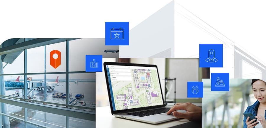
Con el objetivo facilitar la gestión de espacios y aforos mediante el análisis de datos geográficos, Esri, proveedor de sistemas de información geográfica (GIS) y location intelligence, ha presentado dos innovadoras soluciones que dan respuesta a esta demanda de manera segura.
La primera de las soluciones permite controlar los accesos de manera segura a instalaciones, such as museums, instalaciones recreativas e incluso eventos al aire libre, con vías de entrada y salida controladas por persona.
Esta solución consta de tres elementos principales para facilitar la toma de decisiones, both for facility managers, and for users. For example, the visitor of a museum can know in advance the occupancy of the exhibition area.
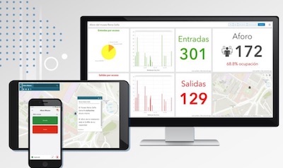
 Mobile phone app, intended for counting people entering and leaving. The application uses ArcGIS QuickCapture technology and is configured with two buttons: one to mark entry and the other exit, especially useful for staff in charge of access control.
Web application, aimed at anyone who needs to access the facilities of a venue and wants to know its occupancy, with information on the number of visitors and the occupancy percentage in real time through interactive maps.
Dashboard, which uses the information collected by the apps so that the person responsible for facility security can make decisions in real time, such as stopping or reactivating access to a room.
Besides, the dashboard shows historical information that can be analyzed to discover patterns, such as the times and days with the highest attendance, with the aim of making more precise decisions that improve space management.
 The solution is easy to deploy thanks to a deployable template developed by Esri in ArcGIS Online, its SaaS platform, so that its production deployment is quick, regardless of the needs of each organization. It is enough to configure the three applications and the workgroups with the users who will edit and consult the information.
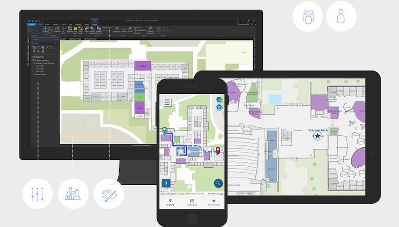
The second solution, based on ArcGIS Indoors, connects facility users with their assets, allowing real-time monitoring of occupancy; having an asset catalog, for example, of meeting rooms; 3D view of spaces; real-time indoor location for visitors, as well as communication between teams and real-time monitoring of maintenance tasks.
In this way, asset and space management is facilitated for users, both from the perspective of management and maintenance, como del uso y explotación por parte de empleados de una empresa que deseen reservar una sala de reuniones o que quieran notificar la necesidad de limpieza o mantenimiento, guiarse en un mapa tridimensional de las instalaciones, etc.
¿Te gustó este artículo?
Subscribe to our NEWSLETTER and you won't miss anything.